
Other Data Sources
We are fortunate in SLO County to have a variety of other data sources to inform our work. Check out just a few of them below.

KidsData
Data about the health and well being of children in communities across California.

Community Foundation of SLO County Reports & Data Center
A collection of reports to help raise public awareness around needs, trends, and emerging issues in San Luis Obispo County.

CDPH Office of Health Equity Data Project
The Healthy Communities Data and Indicators Project (HCI) provides data on incomes, food affordability, air pollution, access to parks and more.

CA Open Data Portal
A statewide open data portal created to improve collaboration, expand transparency and lead to innovation and increased effectiveness.

CalSCHLS
CalSCHLS dashboards examine the most recent state and local CA Healthy Kids Survey results, trends over time, and disparities in survey outcomes across subgroups.

SLOMICS
The San Luis Obispo Mexican Indigenous Community Study (SLOMICS) has summaries of study findings on the demographics, health needs, and living conditions of the Mexican and Latinx Indigenous communities.

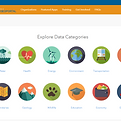
SLOCOG Regional Data Center
A local data hub, hosted by SLOCOG, which allows users to explore data by category, view map applications, and download GIS data.
California State Geoportal
Access to mapped state data on topics like health, land use, energy, and more, that you can explore, visualize and download.

DataQuest
DataQuest provides data about K-12 students that supports a wide variety of informational, research, and policy needs. Summary and detailed data reports are available for multiple subject areas at the school, district, county, and state levels.

ParkServe
The Trust for Public Land's ParkServe is one of the most comprehensive databases of park access levels in urban cities and towns.
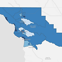
SLO County Food Access & Participation Map
Interactive map of SLO County that shows CalFresh participation among all individuals who are eligible. Other map layers show Food Bank distribution sites and income by census tract.

California Health and Human Services Open Data Portal
Public access to one of the State’s most valuable assets – non-confidential health and human services data.

CalEnviroScreen
Interactive map of CA census tracts which shows the pollution burden for communities alongside population characteristics, like asthma and education.